Service Navigation
Search
The northwesterly flow is similar to a westerly flow, but the centres of activity (highs and lows) shift. Switzerland is subject to a northwesterly flow when the Azores high over the nearby Atlantic expands northwards and there is an area of low pressure between Scandinavia and Eastern Europe. This flow carries with it cool, damp polar sea air over to Switzerland. Precipitation is less common when the flow is determined by an area of high pressure. On the other hand, it rains more frequently when the flow is determined by an area of low pressure. If the flow is oriented in a more northerly direction, then cold Arctic air is carried to Switzerland. Such a northerly flow generally carries less moisture than a northwesterly flow.
Frequent cloud and snow in winter
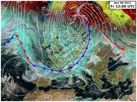
It is in winter that the northwesterly flow is the most common and most dynamic. The weather is normally cloudy on the northern side of the Alps, with frequent precipitation all along the northern front range of the Alps (Prealps) and in the Jura region. This can result in heavy snowfall. The temperatures tend to be close to the average, and snow can fall even in low-lying areas. Whilst the wind blows in a northwesterly direction at high altitudes, over the Swiss plateau it blows from the southwest. If cold air reaches the back of a front, the Joran may occur over the foothills of the southern Jura, which will then provide the conditions for larger areas of clear sky to develop over the Swiss plateau. Thanks to its northerly foehn situation, the weather on the southern side of the Alps tends to be mostly dry and sunny. However, clouds and precipitation can move towards the south if there is a strong flow.

If the northwesterly flow is determined by a low and is dynamic, a low can form over the Gulf of Genoa, which then influences the weather on the southern side of the Alps.
Cool and rainy in summer
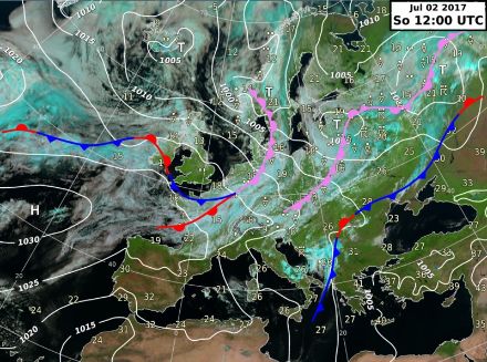
Northwesterly flows are less common in summer than in winter, and much less dynamic. This means that the winds are weaker in summer. The weather is often cloudy, with showers and the occasional thunderstorm. Temperatures are generally below average. As is the case in winter, precipitation falls mainly over the northern slopes of the Alps and along the Jura. If the air mass is unstable, the southern side of the Alps can also be subject to showers and thunderstorms.
