Service Navigation
Search
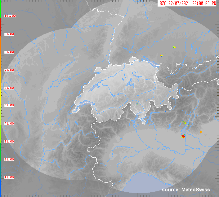
Extended radar products are grid datasets that provide information about specific meteorological phenomena, such as the intensity of a convection phenomenon or the presence of hail in conjunction with a thunderstorm. The information provided by these products is more detailed than that of the basic radar products.
The following types of data are available:
- PRECIP-ACCU: Total radar-estimated precipitation over 1, 3, 6, 12, 24, 48 and 72 hours
- POH: Probability of hail, expressed as a percentage
- MESHS: Maximum expected severe hail size (in cm).
- VIL: Vertically integrated liquid [kg/m2]
All extended radar products cover the same region as the basic radar products: Switzerland and neighbouring regions. The five-minute update rate of these products, together with their fast computation speed, makes them suitable for nowcasting systems with high spatial and temporal frequency. The quality tends to be better for Switzerland and for regions close to the border, due to the higher density of radar observations in those areas. The greater the distance from the Swiss border, the less reliable the products.
|
Parameters |
Sum of radar-estimated precipitation over 1.3, 6, 12, 24, 48 and 72 hours; probability of hail; maximum expected severe hail size; vertically integrated liquid |
|
Frequency of data delivery |
Every 5 minutes/hourly/daily |
|
Spatial resolution |
1 km2 |
|
Data available / archived data |
from 1st January 2011 |
|
Coordinates system |
Swiss land coordinates |
|
Data quality |
The quality of the extended radar products depends on a range of factors that vary from product to product. Generally speaking, the quality is determined by static and dynamic factors. The static factors include distance from the nearest radar, the number of available observations (one or more radars may cover the same region) and the orography, for example. In terms of dynamic factors, the weather situation plays an important role: Heavy precipitation with strong vertical development is easier to identify. Further information (in English): Germann U.; Boscacci M.; Clementi L.; Gabella M.; Hering A.; Sartori M.; Sideris IV; Calpini B. 2022: Weather Radar in Complex Orography. Remote Sens. 2022, 14, 503. |
|
Formats |
GIF, HDF5, GeoTiff (for all of Switzerland only) ASCII, GeoTIFF (including individual sections) |
|
Price |
As per individual quotation |