Service Navigation
Search
High-quality images and data
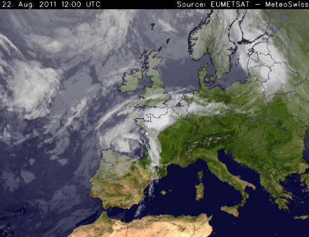
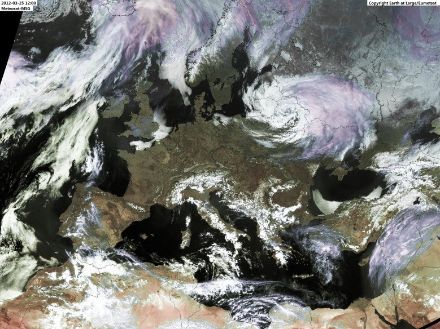
Weather satellites allow us to observe meteorological processes in the atmosphere around the clock. These geostationary satellites are located over the equator at an altitude of 36,000 km above the Earth’s surface. Their position allows them to provide valuable information about what is occurring in the atmosphere, both over the landmasses and the oceans.
In addition to transmitting images showing the type and extent of clouds in the atmosphere, weather satellites also provide important meteorological information such as the temperature of the cloud top or the vertical humidity profile in the atmosphere. MeteoSwiss does not own any weather satellites itself. However, as a founding member of EUMETSAT, the European Organization for the Exploitation of Meteorological Satellites, it receives data and information from European and various other international weather satellites. On the basis of these data, detailed images are produced that indicate the distribution, development and movement of clouds.
MeteoSwiss not only processes satellite data and images for its own internal use – as a national weather service, it also makes them available to other public agencies and private individuals on request. The satellite images processed by MeteoSwiss are put to a variety of uses, ranging from civil and military aviation purposes (for air-traffic safety management and flight operations), to animations on websites and in apps.
Various types of satellite imagery are published free of charge on the MeteoSwiss website and in the MeteoSwiss App. Image types include high-resolution images for detailed cloud view (only available during the day), infrared images to closely monitor fog formation both during the day and at night, and composite images indicating the different cloud types using specific colour coding.
For customers with specific requirements, high-resolution data sets of temperature, humidity or other meteorological parameters are also available for further processing by the customer.
Tailored to your requirements
In addition to its free products and services, MeteoSwiss provides satellite images in GIF, PNG and other formats, as well as in different temporal resolutions (5, 15 or 30 minutes and 1, 3, 6 or 24 hours). The images can cover a very broad range of regions: from a small section of the Alps, to a composite image of the entire surface of the Earth. The experts at MeteoSwiss can advise enquirers on how to obtain suitable satellite images for their needs.