Service Navigation
Search
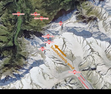
A rare regional variant of the southerly foehn is known as the Guggifoehn, which, unlike the typical southerly foehn (a downslope wind), primarily occurs during a prevailing southeasterly airflow. The Guggifoehn takes its name from the Guggi Glacier (Guggigletscher), over which the wind intensifies as it descends.
The origins of the Guggifoehn
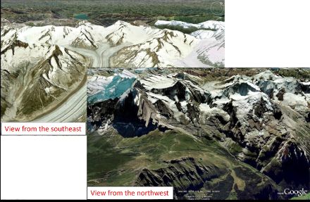
The Guggifoehn primarily occurs when a southeasterly airflow prevails over the Alps, blowing over the Bernese Oberland trio of Eiger, Mönch and Jungfrau and ascending the Aletsch Glacier (Aletschgletscher) on the windward side before plunging down the Guggi Glacier between Jungfrau and Mönch. With their southeast-northwest orientation, the glaciers are perfectly placed for the characteristic drying, warming and acceleration of the foehn wind, allowing it to sweep unimpeded into the Lauberhorn region. This will often trigger hurricane-force gusts several times a year in the Kleine Scheidegg and Lauberhorn areas.
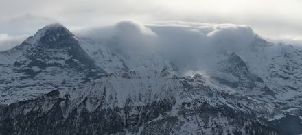
The Guggifoehn is one of the most extreme weather events in the Alpine region, as it regularly produces hurricane-strength gusts.
Typical manifestations of the Guggifoehn
At the Jungfraujoch weather station (3,571 m a.s.l.), the Guggifoehn manifests as southeasterly winds, with gusts only 10–20 km/h higher than average winds. However, at the Lauberhorn weather station (2,315 m a.s.l.), the wind also comes from the southeast, and is on average of similar or slightly greater strength compared to the winds on the Jungfraujoch, but the gusts are significantly stronger – often 40–50 km/h higher than the average wind speed, highlighting the gustiness of the foehn.
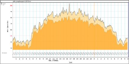
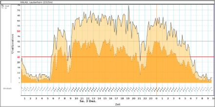
For example, on 3 December 2022, during a classic Guggifoehn event, we see that the gusts recorded at the Lauberhorn weather station were significantly higher. Gusts on the Jungfraujoch peaked at 95 km/h, whereas the Lauberhorn station recorded gusts of up to 137 km/h.
In December 2008, the Lauberhorn station recorded an extraordinary gust of 252 km/h during a Guggifoehn event.
The southeasterly airflow typical of the Guggifoehn also shifts the zone of intense orographic precipitation on the southern side of the Alps. Unlike a ‘normal’ southerly foehn phase, in which the heaviest rainfall occurs in Ticino, southeasterly airflow redirects this precipitation westward, significantly affecting the Simplon region.