Service Navigation
Search
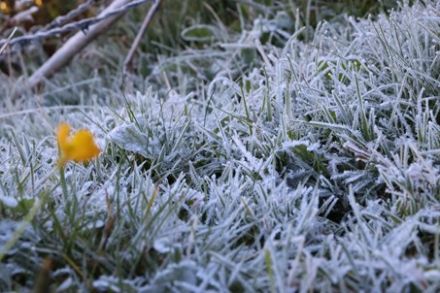
Ground frost is a sign that the temperature close to the ground has dropped to freezing point or below. This is usually measured by a temperature sensor placed about 5 cm above the ground, normally on grass. The unmistakable, visual evidence of frost is exactly that – a frosty coating on the surface of the ground, which forms when the moisture in the layer of air closest to the ground precipitates directly onto the cold surface and freezes.
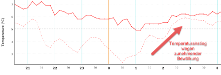
During nights when the skies are clear and the ground can cool down unhindered (so-called radiation nights), the temperature at 5 cm above ground level is significantly colder than at 2 metres, where the normal air temperature is measured. The less cloud cover, the greater the temperature difference. The air close to the ground is generally up to 5 degrees colder than it is at 2 metres.
The preconditions for heavy ground frost
Certain conditions must be fulfilled in order for heavy ground frost to form. The most important of these is the presence of a cold air mass, which usually comes our way from the North or North-East:
Additional conditions:
- Topography: Cold air collects in basin areas; on slopes and in hilly areas, it flows with gravity.
- Minimal wind to prevent constant mixing and warming of cold air next to the ground.
- Clear night skies for effective longwave heat radiation.
- Dry air to prevent the formation of fog or low-lying cloud over the course of the night.
The first ground frost
In the lowlands on the northern side of the Alps, the first autumn ground frosts can be expected from September onwards. However, at the measurement locations in Geneva and Payerne, where long-term temperature measurement series exist for both locations at 5 cm above ground level, the first autumn ground frost predominantly occurred in October. In a small number of years, the first frost was delayed until early November.
Even in the shorter series from 1981, the first autumn ground frost is by and large an October phenomenon. One striking exception is seen with the measurement location in Bern, where the first autumn ground frost was observed predominantly in September and occasionally even as early as the end of August.
In the lowlands on the southern side of the Alps, the first ground frost can be expected in the second half of October. At the measurement location in Lugano, the first autumn ground frost usually did not occur until November or December.
The last ground frost
A daily minimum temperature of -6 degrees at 5 cm above ground level is not uncommon in the central lowlands in April; occasionally, temperatures dropped below the -10 degrees mark.
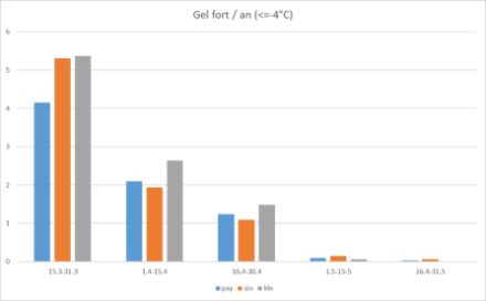
Subzero temperatures close to the ground are not a rare occurrence at the beginning of April. Between 1 and 15 April every year, we have on average one to two heavy frost days, when the temperature is below -4°C at 5 cm above the ground. Such frosts can present a significant hazard, depending on the growth stage of the vegetation. In recent years, farmers, vintners and vegetable growers in our country have experienced three severe frosts, namely on 7 April 2015, 20 April 2017 and 7 April 2021.
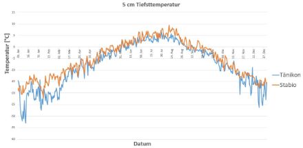
Heavy ground frosts can even occur in May. For instance, on 1 May 1984, in Tänikon, a minimum temperature of -6.5 degrees was recorded at 5 cm, and in Kloten, the temperature dropped to -5.2 degrees as late as 7 May 2019.
The situation is not markedly different in the valleys on the south side of the Alps: in Stabio, for instance, 5-cm temperatures have often dropped below -6 degrees in April, and in 1997, a temperature of -3.9 degrees was recorded as late as 9 May.
Light ground frosts can occur in low-lying areas, especially in valleys, even in June; and above 1,000 meters, 5-cm temperatures can hover just below freezing in many places, even in midsummer.
Combatting frost in agriculture
On clear nights, cold air lakes with temperatures several degrees lower can form in low-lying areas or valleys. For this reason, most of the apricot orchards in the Valais are located on elevated slopes.
A sprinkler system is an effective way to combat frost when it is not too severe. This method is primarily used with fruit trees and some crops that grow close to the ground. Contrary to popular opinion, it is not the insulating properties of ice that are at play here, but rather the property of water (H2O) when it freezes. Water releases heat when it transitions from a liquid to a solid. One gramme of water produces 333 J or 80 cal when freezing. A significant portion of this energy is released into the atmosphere, but what remains is sufficient to keep the plant at a temperature of around 0°C to allow it to survive. For this process to continue throughout a frosty night, however, liquid water must be continuously supplied, as a temperature of 0°C can only be maintained when ice forms.
Another method of combatting frost involves the use of heaters or paraffin candles. Some fruit trees are more delicate and can break under the weight of ice. In such cases, candles are placed near the trees in the orchard. It would be fanciful to believe that candles can warm the air in the surroundings; however, they do provide counter-radiation to help prevent the plants from cooling down too much.
Ground frost warnings
In spring especially, ground frost can lead to frost damage in agriculture and horticulture. Between 15 March and 31 October, MeteoSwiss therefore issues warnings when ground frost is forecast. These warnings apply for low-lying areas below 600 m.
The following terminology is used in the warnings:
- Minimum temperature of 0 to -4 degrees at 5 cm above ground level: moderate ground frost
- Minimum temperature below -4 degrees at 5 cm above ground level: heavy ground frost
Ground frost does, of course, occur during the six winter months, but because it is not unusual at that time of year and, moreover, vegetation is dormant during the winter, warnings are not issued then.
What to do in the event of ground frost
Ground frost can cause damage to plants and also hinder construction activities. The main factors that influence frost formation are the nighttime temperature, cloud cover, and wind.
The following protective measures can limit frost damage:
- Cover plants with fleece and place particularly vulnerable potted plants against a house wall or indoors.
- Protect construction sites and sensitive materials from frost damage.