Service Navigation
Search
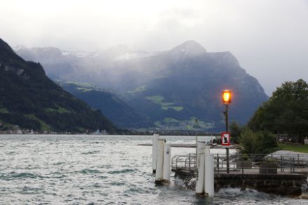
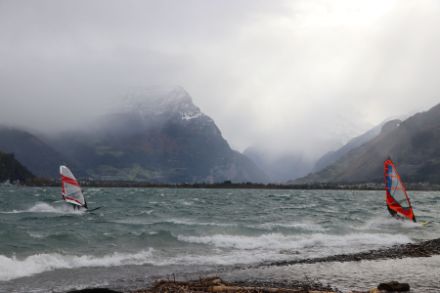
One special form of the foehn is the dimmerfoehn, which, unlike the typical southern foehn (known for its dry air and sunny weather on the leeward side of the Alps), transports significant amounts of moisture from the south across the Alps. The downward motion of the air associated with the foehn is not sufficient to dry the atmosphere, so even in the foehn areas, with their strong and gusty southerly winds, the weather remains misty, overcast and rainy.
The name ‘dimmerfoehn’ comes from the word Dimmer, which is used in the dialects of the Uri and Glarus regions and means ‘gloomy’, ‘dusky’ or ‘dark’. Because the weather is overcast and rainy, and often with low cloud cover, the light during the day is usually dim.
In 2015, the AGF (Working Group on Foehn Research in the Rhine Valley-Lake Constance Area) submitted the following definition of dimmerfoehn to the WMO (World Meteorological Organization): ‘Dimmerfoehn, a form of foehn in which humid air extends across the mountain ridge causing precipitation and poor visibility unusually far to the leeside.’ This definition has since been accepted by the WMO and translated into various languages.
Dimmerfoehn – formation and characteristics
Two main conditions must be fulfilled in order for the dimmerfoehn to occur. Firstly, the air mass moving from the south towards the Alps must be highly saturated with moisture. Secondly, the southerly or southwesterly airflow must be exceptionally strong, allowing moisture and precipitation to be transported unusually far north.
The typical foehn effect of air descending on the northern side of the Alps does not dry the air sufficiently to allow the cloud cover to dissipate. This means that areas such as Altdorf, Glarus, Elm or Chur may experience foehn winds, but precipitation will also occur. This situation affects the usual foehn areas that typically enjoy sunny weather through the ‘foehn window’ but in this case experience gloomy or rainy weather instead, despite gusty southerly winds.
In less pronounced cases, the precipitation is only recorded by rain detectors (droplet counters) and not in the conventional rain gauges.