Service Navigation
Search
Satellite observations are of central importance for the preparation of weather forecasts. Geostationary satellites provide a precise picture of the weather for very large areas of the earth, practically in real time. The weather satellites transmit their data every few minutes, which makes it possible to continuously track changes in the atmosphere. Satellite data are used by our meteorologists to get an overview of the weather situation. Furthermore, they are also used in nowcasting (very short term prediction) and are essential to determine the initial conditions for numerical weather simulations. Furthermore, satellite meteorology is gaining importance worldwide for the observation of climate variables.
Meteosat Second Generation (MSG)
MeteoSwiss uses mainly measurements from Meteosat Second Generation (MSG). The MSG satellites are in a geostationary orbit at an altitude of 36,000 km above the intersection of the equator and the Greenwich meridian.
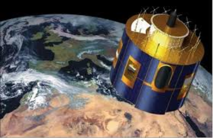
From this position, MSG can observe about one third of the globe. The main instrument of Meteosat Second Generation is a multi-spectral camera called SEVIRI (Spinning Enhanced Visible and InfraRed Imager). The SEVIRI instrument has twelve channels (8 infrared, 1 near infrared e 3 visible). An MSG satellite observes the entire Earth's disk visible from this position and delivers a measurement every 15 minutes. A second satellite concentrates on the northern third of the visible disk of the Earth and can thus take a picture of Europe and the North Atlantic every 5 minutes. Satellite measurements are usually displayed as images. This allows not only to detect different cloud layers, but also the transport of Sahara dust or ash clouds from volcanoes can be shown by combining different channels.
Meteosat Third Generation (MTG)
From 2023, the next generation of geostationary satellites will be released into space, whose new instruments will be able to observe the Earth in even greater detail.
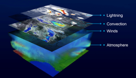
The MTG constellation will consist of four satellites with imaging cameras (MTG-I) and two satellites with sounding instruments (MTG-S). The MTG-I is equipped with the Flexible Combined Imager (FCI), a further development of the SEVIRI instrument. FCI has 16 spectral channels (SEVIRI has 12 channels), the spatial resolution in the infrared range is 2 km, in the visible range even 1 km (most SEVIRI channels have a resolution of 3 km). The first MTG-I satellite will take an image of the visible disk of the Earth every 10 minutes. A second MTG-I satellite will take a picture of the upper quarter every 2.5 minutes. This satellite will record four channels with double the spatial resolution, which will allow fast developing thunderstorms to be measured with high precision. MTG-I also has a new type of instrument on board, the Lighting Imager (LI), which for the first time can be used to record lightning activity over Europe from space. The MTG-S sounding mission has two spectrometers on board. The Infrared Spectrometer (IRS) measures temperature and humidity profiles, while the UVN spectrometer is designed to observe air quality and the chemical composition of the atmosphere.
EUMETSAT
The Meteosat satellites and other Earth observation satellites are operated by the European Organisation for the Exploitation of Meteorological Satellites (EUMETSAT). After the satellite data have been measured, they are transmitted to the EUMETSAT headquarters in Darmstadt (Germany) where they are calibrated and georeferenced. Then, they are distributed to the end users, mainly the national weather services and private weather service providers. After further processing, MeteoSwiss delivers various satellite products to its internal and external customers such as weather forecasting services, automatic nowcasting systems, climate researchers or the media.
MeteoSwiss provides up-to-date satellite images of cloud distribution every 15 minutes free of charge under Measured values. Under “Service & Publications” many other satellite images can be obtained for a fee. These can be specially adapted to your design requirements and are available with a time resolution of up to 5 minutes.
Day & night combined satellite image of Europe
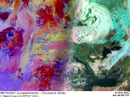
The combined satellite images use different colours to display day and night, which allows the different cloud types to be more easily distinguished from each other.
Infrared satellite image of Europe
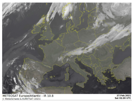
The European geostationary weather satellites measure the electromagnetic infrared rays emitted from the ground and from the upper portion of the clouds. The infrared emissions can be measured 24 hours a day, which means that this type of satellite image can provide important information about the distribution and development of clouds around the clock.
Global satellite images
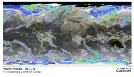
These infrared images provide practically a global indication of cloud distribution (excluding the polar regions). The mosaic images are created by combining images from the European, American and Japanese geostationary weather satellites.