Service Navigation
Search
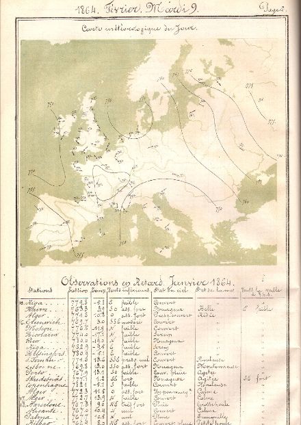
Coordinated weather observation
Under the direction of the Swiss Association of the Natural Sciences, weather observations were launched at 88 stations in Switzerland. A meteorological office attached to the observatory in Zurich was established as a coordination and evaluation centre. Measurements began in 1864, meaning that 2024 marks 160 years of weather records in Switzerland.
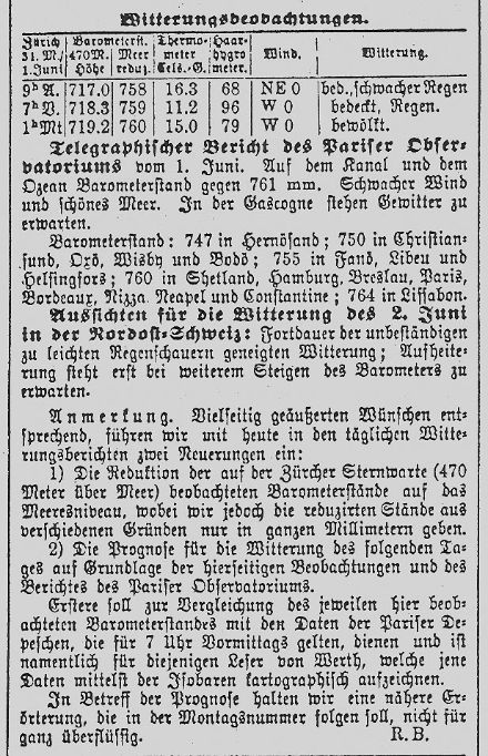
Daily weather forecasts
The demand for more frequent forecasts increased, with growing calls from the agricultural sector for daily weather forecasts such as those already seen in France. Daily next-day forecasts started in the late 1870s.
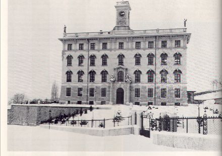
Establishment of the Central Meteorological Institute
Following a decision by the Swiss Federal Council in 1880, the Central Meteorological Institute (Meteorologische Zentralanstalt, or MZA) – the precursor for MeteoSwiss – was established in Zurich one year later.
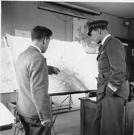
Weather information for aviation
Against the backdrop of increasing air traffic, the aviation weather service, a branch of the Meteorological Institute, was launched. Aviation weather observations were subsequently carried out at the Zurich-Dübendorf, Geneva-Cointrin and Basel-Birsfelden airfields.

Establishment of new sites
The Zurich site was joined by the Centre météorologique de Genève (in Geneva) in 1931 and the Osservatorio Ticinese (in Locarno-Mont) in 1935, now known as "MétéoSuisse Centre Régional Ouest" and "MeteoSvizzera Centro Regionale Sud" respectively. The aerological, or upper-air, station in Payerne was commissioned in 1941.
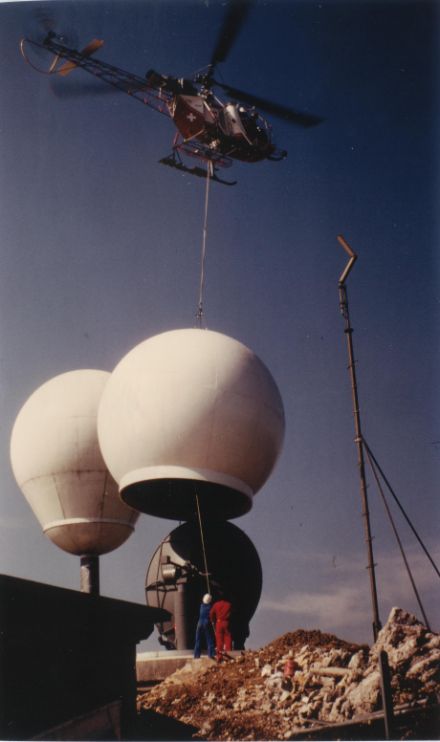
First weather radar stations of MeteoSwiss
Switzerland introduced a weather radar network with the inauguration of sites on the Albis and La Dôle. Key information, especially on precipitation and thunderstorms, was collected and evaluated by observing the atmosphere. The third radar installation, Monte Lema, opened in 1994, with a further two commissioned in 2014 and 2016.
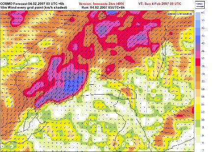
The digital weather model
MeteoSwiss introduced its first digital weather model in 1994. At that time, the model had a resolution, or "mesh size", of 14 km. The resolution of current forecast models (COSMO-1E and COSMO-2E) is many times higher (1 or 2 kilometres).
New law – new name
On 1 April 2000, the completely revised Federal Act on Meteorology and Climatology came into force, replacing the Federal Act of 27 June 1901 on the Swiss Central Meteorological Institute. The Central Meteorological Institute was renamed the "Federal Office of Meteorology and Climatology (MeteoSwiss)".

Data warehouse
The MeteoSwiss data warehouse, a new database, made all the data from all land-based weather stations available in one central location for the first time.

Establishment of the federal agencies with responsibility for natural hazards
The six federal agencies with responsibility for natural hazards are coordinated by the Steering Committee on Intervention in Natural Hazards (LAINAT) and work closely together in all situations. As a member of LAINAT, MeteoSwiss monitors the weather, generates weather forecasts and warns the authorities and the public of imminent severe weather
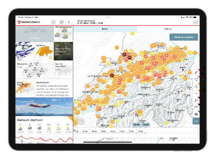
Weather data on your mobile device
MeteoSwiss launched the MeteoSwiss App, enabling users to access current weather information at any time wherever they are. It features weather forecasts, current measurement values, the MeteoSwiss blog about weather and climate (in French, German and Italian), and information on all natural hazard warnings.

Headquarters at Zurich Airport
As the national aviation weather service, MeteoSwiss is a meteorological watch office (MWO) and is responsible for weather forecasts and warnings for Switzerland's airspace. Given that many of MeteoSwiss's long-standing partner organisations were already based at Zurich Airport, the office moved its headquarters to the airport's Operation Centre 1 in 2014
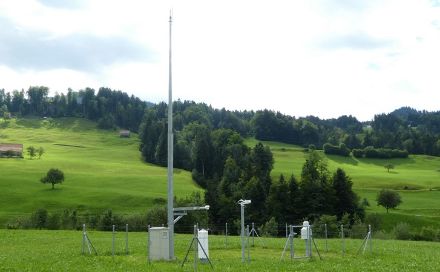
Automatic measuring stations
This was the year when MeteoSwiss completed the modernisation and expansion of the national meteorological ground-level measurement network. SwissMetNet, the automatic measurement network of MeteoSwiss, comprises around 160 automatic measuring stations. These stations deliver a multitude of current data on weather and climate in Switzerland every ten minutes. The network is supplemented by 100 automatic precipitation stations. Together, these stations form the basis for the creation of reliable local weather forecasts as well as severe weather warnings.
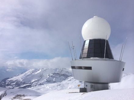
New radar data from the cantons of Valais and Graubünden
One of the core duties of MeteoSwiss is to observe the atmosphere and weather developments. With the opening of radars on the Pointe de la Plaine Morte in 2014 and on the Weissfluhgipfel in 2016, MeteoSwiss now operates a total of five weather radar stations. These stations record precipitation and storms in real time, are fully automated and, between them, cover the whole of Switzerland. Together, the radar data from the Pointe de la Plaine Morte in the canton of Valais and from the Weissfluhgipfel in the canton of Graubünden improves the recording of precipitation in the inner Alpine regions

Weather supercomputer
Since 2015, MeteoSwiss has used a high-performance computer, also known as a supercomputer, at the Swiss National Supercomputing Centre (CSCS) to make weather forecasts. New graphics processors expanded the computing capacity by a factor of 40. By switching to a heterogeneous GPU-based architecture (GPU = graphics processing unit), it was also possible to more than triple the energy efficiency of its forecasts.
In 2016, MeteoSwiss and CSCS won the Swiss ICT Award for their joint weather supercomputer project. This new way of calculating huge volumes of weather data on a supercomputer was hailed as pioneering by the jury.
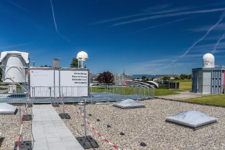
Automatic radio soundings
At the Payerne site, a weather balloon carrying radiosondes ascends into the atmosphere at noon and midnight every day. These instruments measure meteorological values up to high altitudes. This data is key for weather forecasting and climate research. Since 2018, the facility used to carry out radio soundings has been operated fully automatically at night.
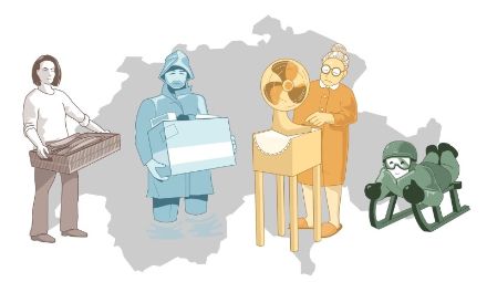
CH2018 Climate Scenarios
The CH2018 Climate Scenarios were published in 2018. The Federal Office of Meteorology and Climatology (MeteoSwiss) is officially tasked with producing climate scenarios on a regular basis. They show where and how climate change is affecting Switzerland and illustrate global climate protection measures' potential to mitigate climate change.

Presidency of European meteorological network
Peter Binder, MeteoSwiss Director from 2013 to 2022, became President of the network of European meteorological services EUMETNET in 2018. This organisation's strategy is grounded in collaboration and complementarity between the meteorological services of the 31 member states, and it carries out a full range of projects to this end
Real-time pollen data
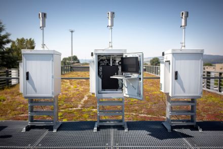
In 2022, the automatic pollen monitoring network began operating at an hourly resolution. In a world first, instead of daily averages being available after a week, the data is now available hourly and in real time. Furthermore, MeteoSwiss makes the data available on its website and app, having become the first meteorological service on the planet to do so.

Meteorology for nuclear accidents (EMER-Met)
MeteoSwiss has been operating the EMER-Met wind analysis and forecasting system for nuclear accidents in Switzerland and neighbouring countries since 2009. The EMER-Met StArt project, carried out in cooperation with the Swiss Federal Nuclear Safety Inspectorate (ENSI) and the Federal Office for Civil Protection (FOCP) and intended to further improve the forecasts for the spread of nuclear or chemical substances, was successfully completed in 2022.
European cooperation on meteorological satellites
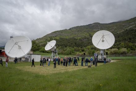
After more than 20 years of development, EUMETSAT (the European Organisation for the Exploitation of Meteorological Satellites) began launching a new generation of geostationary weather satellites into space. A total of six MTG (Meteosat Third Generation) satellites will make a decisive contribution to meteorological and climatological research in the years ahead. In 2022, a new ground station was inaugurated in Leuk in the canton of Valais. Following the launch of the first satellite, this state-of-the-art station with its three 6.5-metre antennas will receive huge volumes of meteorological information every minute, which it will forward to EUMETSAT in Darmstadt, Germany

Open Government Data
On 17 March 2023, the Federal Act on the Use of Electronic Means to Conduct the Tasks of the Authorities was adopted by Parliament, forming the basis for the amendment of the Federal Act on Meteorology and Climatology and the introduction of Open Government Data, or OGD. This represents a major step towards removing the charges applied across the board for the metrological and climatological data provided by MeteoSwiss. The OGD24 project is set to continue work on the technical implementation of OGD and the complete revision of the Ordinance on Meteorology and Climatology
ICON Weather and Climate Model
The ICON Weather and Climate Model has been available to the public under an open-source licence since January 2024.
MeteoSwiss put the ICON Weather and Climate Model into operation in June 2024 (press release). ICON uses an innovative triangular grid that makes a higher and more even resolution possible. By rendering a more detailed depiction of Switzerland’s complex topography, ICON produces more precise weather forecasts than the previous model COSMO. ICON is the result of close collaboration between international partners and demonstrates how beneficial the cooperation between research and national weather services can be.