Service Navigation
Search
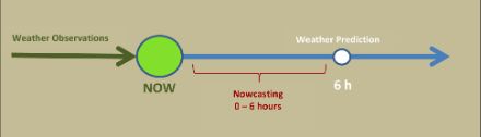
Numerical weather models like ICON predict the weather a few days in advance with good precision on a regional scale. However, for high impact warnings, an even higher local and temporal precision as well as impact assessment are required which is realized through statistical combination of latest observation and weather model forecast prediction. These short-term forecasts can be generated for any number of meteorological parameters, such as temperature, sunshine or precipitation. The focus of nowcasting, however, is on forecasting of and issuing warnings for high-impact weather phenomena , such as severe thunderstorms, heavy rain, hail, wind gusts as well as snow and fog.
The nowcasting systems combine all available information in real time to predict the weather variables of interest as precisely as possible, such as the amount of rain in a river basin in the coming few hours.
For this purpose, radar, the automatic surface measurements, meteorological satellite observation and lightning observations are combined in real time with numerical weather forecasts model data to produce highly detailed and precise short term predictions. A key factor in the success of nowcasting is the rapid communication and processing of measurement data from different monitoring systems.
Diverse applications of nowcasting
MeteoSwiss uses nowcasting for a wide variety of applications. Many of these help with the early detection of hazards such as thunderstorms or heavy rainfall.
The various nowcasting systems of MeteoSwiss.
| Name | Application | Source(s) of data |
|---|---|---|
| NowPrecip | Extrapolation of precipitation fields and blending with ICON NWP model | Radar, CombiPrecip, orography, ICON |
| INCA | Temperature, humidity, wind, rain, precipitation type, snow, clouds, lightnings forecast. | ICON, SwissMetNet, Radar, CombiPrecip, NowPrecip, Nowcasting SAF, lightnings. |
| CombiPrecip | High resolution precipitation measurement with extensive geographical coverage | Amalgamation of radar and rain measurement data |
| NowPAL | Automatic heavy rainfall warnings | Radar, CombiPrecip, NowPrecip |
| TRT | Thunderstorm warning, prediction of the centre of a thunderstorm, hail forecasting. | Radar, lightning measurements, ICON |
| COALITION | Thunderstorm forecast and warning: lightning, precipitation and hail probability forecast | Radar, lightning measurements, orography (optionally ICON and satellite data) |
The weather warnings issued by MeteoSwiss are available by the smartphone app and website of MeteoSwiss. The Swiss government's natural hazards portal provides further information on current hazards.
Nowcasting of thunderstorms
Thunderstorms occur on a regular basis during the six months around summer. This can lead to local flash flooding and landslides, particularly in the Alps and pre-Alpine regions. In addition, strong gusts of wind and large hailstones up to several centimetres in diameter can occur during thunderstorms. Therefore, thunderstorms endanger humans and live stock, cause considerable damage every year to vehicles, buildings and agriculture, and disrupt road, rail and air traffic. It is therefore imperative that up-to-date weather information and forecasts for the coming few hours are available to allow the relevant authorities, civil protection, outdoor event organisers and individuals to take the necessary precautions in good time.
The thunderstorm nowcasting algorithm “Thunderstorm Radar Tracking” (TRT) and the NowPAL algorithm have been in operation for more than a decade. The results of both algorithms are merged into an automatic thunderstorm warning In this way, MeteoSwiss can deliver warnings promptly to all the relevant official institutions and the media in the case of a prevailing or impending hazard. In near future, a new thunderstorm nowcasting COALITION-4 based on deep learning will be introduced in operations.
The combination of different measurement systems in real time allows optimal observation of clouds, thunderstorms, heavy rain and hail cells in their various stages of development. The satellite data are particularly useful for observing the initial cloud formation when there is no precipitation yet. Afterwards, radar observation provide further information on precipitation intensity and formation of hydrometeors such as graupel and hail. The lightning network detects number and strength of the electric activity of the thunderstorm cells. During the most intensive phase of a thunderstorm, all three systems can be used to ascertain the characteristics of the storm. Furthermore, measurement stations provide detailed information about local impacts at the surface (such as wind gusts, heavy precipitation or precipitation type).
Nowcasting of precipitation, temperature, humidity, wind and cloudiness/sunshine
The nowcasting system INCA-CH covers the general meteorological variables (temperature and humidity, precipitation, wind, clouds) with an update every 10 or 5 minutes. The 6h forecast covers Switzerland and adjacent regions with a grid size of 1 km.