Service Navigation
Search
Past: simple methods
Until the turn of the millennium, people primarily relied on the radio, television and newspapers for their weather information. Meteorologists predicted the temperature for just a few locations, often based on a simple set of rules.
For example:
- Climatology: The average temperature for a given season. In Zurich, for example, the temperature fluctuates between 5 and 35 degrees at the beginning of August.
- Persistence: The assumption that the weather the next day will be similar to the day before. For example, if the highest temperature yesterday was 22 degrees, it is likely to be similar today.
- Altitude adjustment: Calculating temperature differences between different elevations, such as in the mountains. The temperature at a standard altitude of 1,500 metres is roughly adjusted to the elevation of the lowlands using a temperature gradient of 1 degree per 100 metres.
- Energy supply from the sun and the air mass: In stable weather conditions with good solar radiation, the maximum daily temperature was calculated in the early morning on the basis of the vertical temperature profile recorded during the night (radiosounding). For this purpose, special diagrams were applied to the radiosounding, which reflect the energy supplied by the sun depending on the time of year. Corrections were added to the maximum temperature determined in this way to take account of any changes in the air mass and mixing due to the wind.
While these methods were often sufficient in the past, far more is expected of weather forecasts today.
Present: weather models and post-processing
Modern weather forecasts rely on numerical simulations of the atmosphere, known as weather models. These models calculate the state of the atmosphere in a three-dimensional grid, while taking into account the physical laws of nature. MeteoSwiss operates the ICON model system and uses the global European model for extended medium-range forecasts.
Challenge: model errors
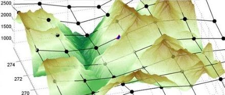
Weather models are not perfect. In the Alps, for instance, the complex terrain with its mountains and valleys cannot be represented totally accurately, which leads to forecast inaccuracies. To ensure computational stability, the landscape has to be simplified in the models. This makes it challenging to produce precise predictions for specific locations, such as the Urner Reuss Valley, because the topography is smoothed in the simulations.
Similar issues arise in the representation of lakes or cities. Such areas influence the weather on a local scale, but the models cannot always capture the complex structures of these regions in detail.
Statistical post-processing: improved forecasting
To improve forecasts, statistical methods are used to correct systematic errors in the models. One example of this is the ‘MOSMIX’ system of the German Weather Service (DWD), which is also used by MeteoSwiss. MOS stands for ‘Model Output Statistics’ and uses model predictions as its starting values.
The model forecasts are compared with actual measurements over a long training period. The correction process works similarly to an archer improving their technique. An experienced archer is already quite accurate under ideal conditions but must adjust their shots in real-world scenarios, such as to account for wind and lighting conditions. In the same way, MOSMIX adjusts the raw model forecasts by eliminating systematic deviations.
In addition to temperature forecasts, other parameters such as wind, cloud cover and ground conditions are included in the statistical equations. This allows systematic errors to be largely corrected, resulting in more accurate temperature predictions.
Interpolation and extrapolation: forecasts for every location
Since optimised forecasts are only available for certain locations, they must be temporally and spatially interpolated for other places. This is where model systems come in again to create continuous temperature trends. When extrapolating station values to the wider area, model grids and real landscape features, such as height above sea level or slope gradients, are taken into account.
This allows statistically corrected forecast values to be generated for every municipality in Switzerland. Thanks to these interpolation and extrapolation steps, we can achieve more reliable forecasts, even for places without weather stations.
Modern technology: forecasts updated hourly
MeteoSwiss calculates new forecasts every hour, integrating the latest measurements and prediction data from incoming weather models. The DWD’s MOSMIX and ECMWF forecasts are updated twice daily. In addition, the ICON-CH1-EPS model runs eight times a day, and the ICON-CH2-EPS model runs four times a day to ensure continually up-to-date forecasts.
Graphical preparation and distribution
In the final step, this data is immediately updated and displayed in visual form on the MeteoSwiss website and app (Local Forecast / My Locations). In the case of temperature, uncertainties are subtly displayed in the background of the trend graphs, helping to provide a clearer understanding of forecast accuracy.
Conclusion
The process of creating weather forecasts is far more complex nowadays than in the past. Thanks to modern weather models, statistical post-processing and continuous updating, precise and location-specific forecasts can be produced, enabling people to better plan their daily lives. Despite the complexity behind the scenes, these steps ensure that weather information remains easily accessible and understandable for everyone.