Service Navigation
Search
Where does this changeability come from? In April, or spring, the oceans and polar regions are still cold. In addition, the sun is now quite high in the sky and the days are becoming longer, which gives the surface of the earth a chance to warm up. When cold polar air pushes towards central Europe, it warms up and rises once it is over the landmass, causing cumulus clouds to form and resulting in the above weather phenomena.
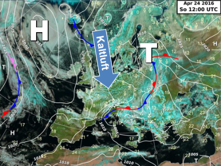
Good April weather conditions are found when there is a stable high-pressure area over northwestern Europe or the nearby Atlantic Ocean with a simultaneous low over Scandinavia, enabling polar air to flow straight to central Europe.
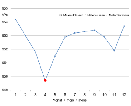
In Switzerland, thanks to its frequently unstable weather, April is the month with the lowest mean monthly air pressure.