Contents area

Context information

.

Footer

Top bar Navigation

Swiss federal authorities

Service Navigation

  • Beginning of the event: 19 August 2005
  • End of the event: 23 August 2005
  • Duration of the event: 5 days

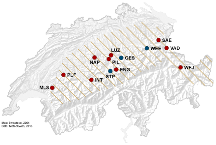
Affected regions: the northern side of the Alps (Plateau, Prealps and northern flank of the Alps) and the Alps (Prättigau, Low-Engadin).

Note: this event affected not only Switzerland, but also parts of Austria (Vorarlberg, Tyrol, Styria, Salzburg) and Germany (south of Bavaria).

Map of Switzerland that shows the affected regions with hatched lines and the stations used for the analysis of the event with dots.
Regions affected by the precipitation event of 19-23 August 2005 (hatched) and stations used for the analysis of the event. Red dots indicate stations measuring hourly precipitation and blue dots indicate stations measuring daily precipitation.