Service Navigation
Search
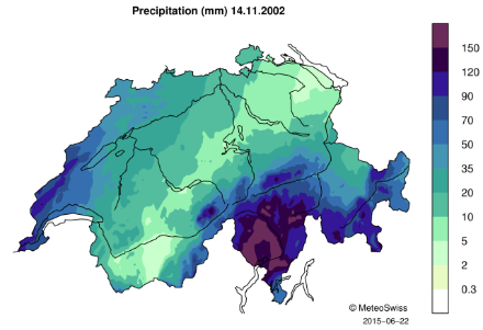
Daily precipitation
During this event, precipitation in western Switzerland was mainly concentrated over and at the foot of the southern Jura mountains. On 14 November 2002, the following rainfall amounts were measured: 93.5 mm at station Genève-Aire, 92.6 mm at station Genève-Cointrin, 87 mm at station Nyon/Changins and 82 mm at station Jussy. For the stations in the region of Geneva, this represents slightly more than the normal November monthly precipitation (norm 1981-2010) which is of 84 mm for Genève-Aire and 89 mm for Genève-Cointrin. Thus, on 14 November the region of Geneva received as much rainfall in one day as it usually receives during the entire month of November.
High daily precipitation sums were also measured in southern Switzerland (Ticino and the Grisons). These regions received high rainfall amounts between 13 and 17 November and are presented as another event for which the description can be found here: 13-17 November 2002.

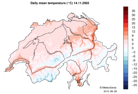
Daily mean temperature
During this event temperatures in the Geneva region were above 0°C with a daily mean temperature of 6.7°C measured at station Genève-Cointrin and 5.9°C at station Nyon/Changins.

Downloads
RhiresD is the spatial analysis of daily precipitation in Switzerland. The daily precipitation on day D corresponds to the rainfall and snowfall water equivalent accumulated from 06:00 UTC of day D to 06:00 UTC of day D+1. For more information about this data set, see the documentation given below.
TabsD is the spatial analysis of the daily mean air temperature 2m above ground level and is representative of the average from midnight to midnight UTC. For more information about this data set, see the documentation given below.